
Facts below are drawn from the linked sources.
Approximate area. The map shows only a rough area for this place, not an exact location.
Real history
Picher was named for O.S. Picher and had more than 14,000 miners at its peak; its population peaked in 1926. The area became part of the Tar Creek Superfund site in 1983. An EF4 tornado struck on May 10, 2008; the town was disincorporated on September 1, 2009, and dissolved on November 26, 2013 (Wikipedia).
Ghost stories
We found no well-sourced ghost legends for this place. It is listed for its abandoned history.
Then and now
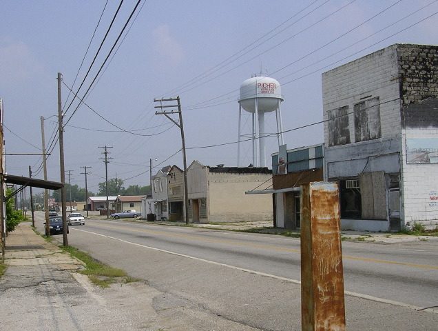

Public access
Access unverified No official access page was found. The map pin is approximate. Last checked: Nov 1, 2026.
Explore more
- More places in Picher and Oklahoma
- More haunted & abandoned ghost towns
- Nearby: Cardin (Cardin, OK), Treece (Treece, KS), Hockerville (Hockerville, OK), Peel Mansion (Bentonville, AR)
⚠️ Please read: This information may be outdated and conditions change. Verify access with the owner or operator before you go. Spook Atlas does not encourage trespassing. Entering private, closed or condemned property can be illegal and dangerous. Report a correction.
Reader experiences
Not yet accepting submissions. Reader stories are coming later; this form is switched off and sends nothing. All stories are moderated before they appear. Posts describing trespassing, break-ins or how to get into closed areas are removed.